About This Website
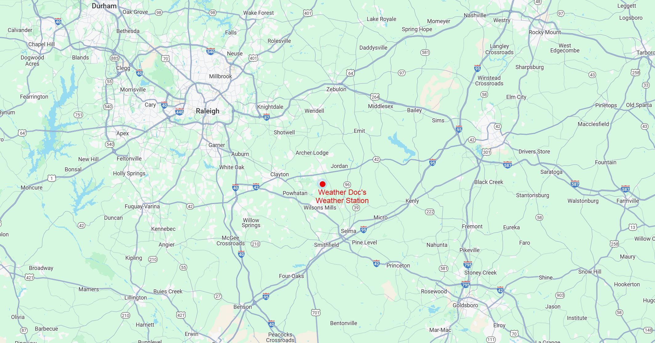
This website provides local weather data and forecasts for central North Carolina and is located 6 miles southeast of Clayton in Portofino.
The weather station and website is privately owned and operated and the data should not be used for official weather information.
About the Weather Station at Portofino
Harware Components
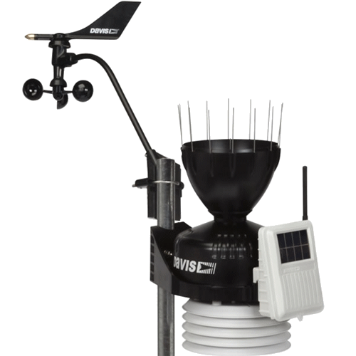 |
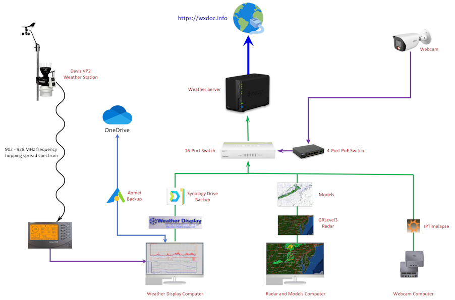
Weather Station After operating for 6 ½ years at Willowsford Farm, Virginia, the Davis Vantage Pro2 was installed at Portofino near Clayton, North Carolina on July 5, 2024. The outdoor Integrated Sensor Suite (ISS) consists of a solar powered suite of sensors that measure temperature, humidity, rainfall, wind speed and wind direction. The "bee hive" shield at the base of the ISS protects the temperature and humitidy sensors against solar radiation and other sources of radiated and reflected heat. The electronic components, including the wireless transmitter operating at 920-928 MHz, are located in a weather-resistant case behind the solar panel. The rain gauge is an automatic tipping bucket type. The temperature, humidity, and rainfall sensors are mounted on a 4x4 pressure treated post, 4½ feet above the grass. The wind sensors (cup anemometer and wind vane) were replaced on July 2, 2025 and are mounted 11 feet above ground level on a stainless steel mast. |
 |
ISS Upgrade On September 1, 2025 the Double Spoon Tipping Bucket Rain Collector was replaced with a Pro2 Rain Collector Tipping Single Spoon which is an incremental improvement for both accuracy and durability over the previous generation. |
 |
ISS Upgrade On June 26, 2025 a new daytime aspiration fan replaced the one initially installed on January 1, 2023 as part of the ISS was upgrade that added a Daytime Fan Aspirated Radiation Shield Kit that includes fan, solar panel, additional radiation shield plates, and hardware. The solar-powered fan runs during the day and reduces the effects of daytime radiation. |
 |
ISS Upgrade On January 1, 2024, the ISS was upgraded by adding a Solar Radiation Sensor that measures solar radiation for evapotranspiration (ET) and Temperature/Humidity/Sun/Wind (THSW) Index. |
 |
ISS Upgrade On July 8, 2024, the ISS was upgraded by adding a UV Sensor that measures the sunburning portion of the UV spectrum. |
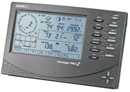 |
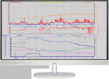
Console Purchased in 2005, the Vantage Pro2 Weather Station console is located indoors and receives the data wirelessly from the ISS, displays and records the data, provides graph and alarm functions, and a data logger attached to the console interfaces to a computer via a serial-to-usb connector. The weather station computer runs Windows 11 and the data is ingested into Weather-Display Software Version 10.37S-(b152). Besides receiving the ISS data, the console measures barometric pressure, indoor temperature, and indoor humidity. |
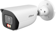 |
Weather Camera On December 29, 2024, a Dahua IPC-HFW3449E-AS-IL® camera with a 2688 ×1520 (5MP) resolution at 25/30 frames/sec was installed. It uses Power over Ethernet (PoE) technology to transmit electric power with data simultaneously over data pairs on Ethernet cable. This permitted a simpler installation by only having to run a single Ethernet cable from the camera to a BV-Tech 4 Port PoE+ Gigabit Switch. IPTimelapse software process the video. |
 |
Rain Gauge On Ocotber 1, 2022, a CoCoRaHS rain gauge was installed. CoCoRaHS is an acronym for the Community Collaborative Rain, Hail and Snow Network. CoCoRaHS is a unique, non-profit, community-based network of volunteers of all ages and backgrounds working together to measure and map precipitation (rain, hail and snow). By using low-cost measurement tools, stressing training and education, and using an interactive Web-site, CoCoRaHS volunteers work to provide the highest quality data for natural resource, education and research applications. The Portofino Weather CoCoRaHS observations can be viewed here: CoCoRaHS Precip Map |
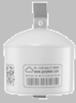 |
Air Quality Monitor On June 13, 2023, a PurpleAir Flex Air Quality Monitor was installed. The PurpleAir Flex measures real-time PM2.5 concentrations and is located on the side of the house. The results are automatically sent to the PurpleAir website for aggregation and analysis. The Portofino Weather PurpleAir real time data can be viewed here: Real Time Data and a local Air Quality Map can be viewed here: PurpleAir Map. |
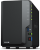 |
Website Server The server runs the Portofino Weather website. On December 27, 2021 the server was upgraded to a Synology DiskStation DS220+ from a Synology DiskStation DS218j. The DS220+ has an Intel Celeron J4025 Dual Core 2.0 GHz processor, burst up to 2.9 GHz with 6GB of RAM and 4TB of RAID storage and over 225 MB/s sequential read and 192 MB/s sequential write throughput. |
 |
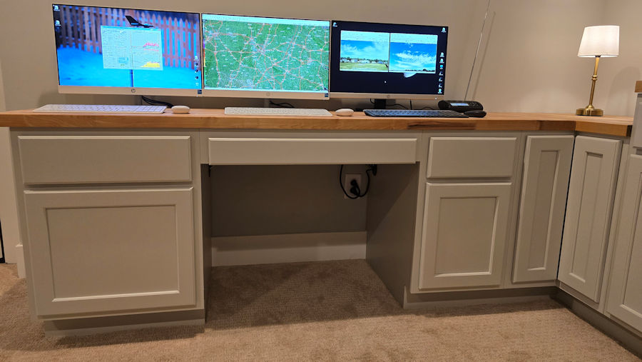
Weather Display Computer On October 20, 2024, the computer running Weather Display was upgraded to an HP 23.8" All-in-One PC running Windows 11 with an Intel® Core i3-N300 Processor, 8GB RAM, and a 512GB Solid State Drive that replaced a Dell Inspiron 15.6" FHD 3501 Laptop. Besides sending weather station data to the server, the Weather Display software also sends data to the Citizen Weather Observer Program (CWOP) (unique identifier is GW5080 showing station quality at here), NWS, NOAA's Meteorological Assimilation Data Ingest System (MADIS), the Weather Underground, Southeastern Weather Network, PWS Weather, and Windy. |
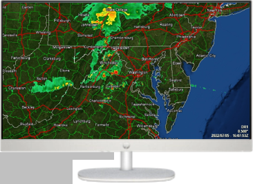 |
Radar and Models Computer On October 20, 2024, GRLevel3 Radar software and Powershell scripts for numerical weather prediction models, local observations, and upper air soundings were migrated to this HP 23.8" All-in-One PC running Windows 11 with an Intel® Core i3-N300 Processor, 8GB RAM, and a 512GB Solid State Drive that replaced a Dell Inspiron 15.6" FHD 3501 Laptop running Windows 11. This computer runs GRLevel3 in a regional view and local view. |
 |
Webcam Computer On November 29, 2024 a Beelink EQR6 Mini PC with an AMD Ryzen 7 7735HS CPU, 24GB DDR5 RAM, 500GB SSD, AMD Radeon 680M 12core GPU assumed all webcam processing from a Dell Inspiron 27 inch All-in-One Desktop PC. This computer produces the Weather Webcam images, timelapses, and streams with IPTimelapse software. |
| Weather Display: | Weather Display receives data from the weather station and outputs real time information to include auto scale and graph history graphing, FTP of the weather data to a webpage, email notifications, web download, averages/extreme/climate/NOAA reports, web cam upload, grouped file uploads, FTP downloads, decoded METAR downloads, APRS output, direct web cam capture, animated web cam images, weatherdials, weather voice, and weather answer phone. |
| PHP/AJAX Templates: | This website is based on the Saratoga-Weather.org PHP/AJAX weather website templates. Using PHP allows this template to require only one file to be uploaded through the weather software for symbolic substitution for weather conditions. The AJAX JavaScript reads a separate, frequently uploaded, conditions file produced by Weather Display software to dynamically update selected parts of the HTML on the pages to reflect current conditions at the Portofino weather station. |
| Hypertext Preprocessor: | PHP (Hypertext Preprocessor) is a widely-used Open Source general-purpose scripting language that is especially suited for web development and can be embedded into HTML. Its syntax draws upon C, Java, and Perl, and is easy to learn. The main goal of the language is to allow web developers to write dynamically generated web pages quickly. |
| PowerShell: | PowerShell is a cross-platform task automation solution made up of a command-line shell, a scripting language, and a configuration management framework. PowerShell runs on Windows, Linux, and macOS. This website uses PowerShell scripts for a variety of tasks to include automatically downloading model files and other graphics, manipulating weather webcam video and image files, updating weather records graphs, downloading the Hourly Roundup observations, and checking the status of weather station batteries & status of the Saratoga-Weather templates for updates and sending a daily email with that information. |
| Highcharts: | Highcharts is a software library for charting and is written in pure JavaScript. The license is proprietary but it is free for personal/non-commercial uses and paid for commercial applications. The Annual and All-time graphs under the Records link of this website are created using Highcharts. |
| GRLevel3: | GRLevel3 is a component of GRLevelX it is a Windows viewer for live and archive NEXRAD Level III data. It displays high resolution base products, dual polarization products, and derived products along with Local Storm Reports and severe weather warnings. GRLevel3 runs on two computers in support of this website producing a regional radar view and a local radar view of the Northern Virginia area. |
| AOMEI Backupper Pro: | AOMEI Backupper Pro is Windows backup software that provides data and system backup protection, supporting install recovery, file sync for exact copy of files, and clone system/disk to directly replace old/damaged disks. This software is used to create a daily backup Weather Display files on the Weather Station Computer by saving them to a OneDrive Cloud. To save space, the entire Weather Display directory is backed-up monthly with smaller, differential backups daily. This ensures the ability to restore all Weather Display files in the event of a catastrophic SSD failure on the Weather Station Computer or if a previous version of a Weather Display file is needed to replace a corrupt file. |
| Synology Drive: | Synology Drive Server used in concert with Synology Drive Client synchronizes files and folders across multiple locations when using a Synology NAS. These files are also regarded as backups. The Synology Drive Client is installed on the Regional Radar and Models Computer and continually syncs all files from the OneDrive folders with the files on the Synology NAS, thereby acting as an onsite backup of all Weather Display files from the Weather Station Computer as well as all scripts and files on the Regional Radar and Models Computer. |
| IPTimelapse: | IPTimelapse is a timelapse and streaming software for Windows. It supports multi-camera, timelapse, streaming, webcam upload, and display of weather observations. This website uses the software to create near real-time still images, timelapses and daily timelapse archives from the Dahua IPC-HFW3449E-AS-IL camera. |
 |
 |
| Page 31 of the CWOP Weather Station Siting, Performance, and Data Quality Guide contains a table called "Determining Optimal Sensor Siting for Your Location". The table provides a method to score the optimal location of a weather station based on several factors. The Portofino weather stations scored 26 out of 30. The less than perfect score is due to the limited availability to properly position the wind sensors. |
| Sensor | Optimal Sensor Location | Portofino Location | CWOP Score | 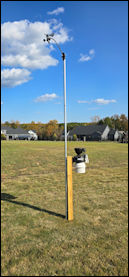 |
| Wind speed and direction | 32 feet above ground. No obstructions. | Mounted on a stainless steel mast 11 feet above ground in an open grass field. No obstructions nearby. | 7 of 10 | |
| Temperature and Humidity | In open, 5 feet above grass. | In open, 4½ feet above grass mounted on a 4x4 pressure treated post. | 10 of 10 | |
| Rainfall | In open, 2 feet above grass. | In open, 4½ feet above grass mounted on a 4x4 pressure treated post. | 9 of 10 |
| Latitude: 35° 37' 57.036" N (deg min sec), 35.63251° (decimal) |
| Longitude: 78° 21' 3.816" W (deg min sec), -78.35106° (decimal) |
| Elevation: 64.7 meters (212 feet) |
 |
Contributors
This site is a template design by CarterLake.org with PHP conversion by Saratoga-Weather.org.
Special thanks go to Kevin Reed at TNET Weather for his work on the original Carterlake templates, and his design for the common website PHP management.
Special thanks to Mike Challis of Long Beach WA for his wind-rose generator, Theme Switcher and CSS styling help with these templates.
Special thanks go to Ken True of Saratoga-Weather.org for the AJAX conditions display, dashboard and integration of the TNET Weather common PHP site design for this site.